STRR and PRR Ring Road Master Plan for Devanahalli in 2026
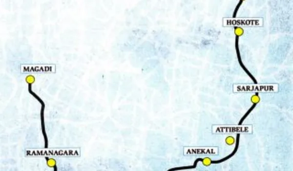
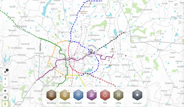
Beyond the airport and the highways, the quieter story shaping Devanahalli's next decade is the ring-road grid: the Satellite Town Ring Road threading the outer towns together, and the proposed Peripheral Ring Road meant to loop the city's edge. For a buyer, these projects matter because they widen the area a home connects to without driving through the congested core, and better regional access has historically lifted land and apartment demand along a corridor. In 2026 the northern belt sits close to this emerging grid.
This guide explains the ring-road master plan around Devanahalli in plain terms: what the STRR and PRR are, how they interact with the airport and the existing highways, and how each milestone can lift access, demand and value, with an honest caveat that these are phased projects whose timelines must be verified. It complements the metro and connectivity timeline guide, which covers the rail and metro side of the same corridor.
Devanahalli Ring Road Master Plan 2026 Overview
The table sets out the main road corridors around the belt and what each one adds.
| Corridor | What it is | What it adds for Devanahalli |
|---|---|---|
| NH-44 / airport expressway | Operational main spine to the city and airport | Today's core access, already in use |
| Satellite Town Ring Road (STRR) | Long outer ring linking satellite towns | Regional access and freight without the city core |
| Peripheral Ring Road (PRR) | Proposed ring from Tumakuru Road to Hosur Road | Faster links to northern and eastern corridors |
| Bengaluru suburban rail | Planned commuter rail on the corridor | Mass-transit access as it comes online |
| Airport metro (Blue Line) | Metro extension towards the airport | Direct rail link to the city, phased |
| Local arterial upgrades | Widening and link roads on the belt | Smoother last-mile within the corridor |
Alignment and status indicative, as of July 2026 — verify the current progress of each corridor with official sources before you rely on it.
What the STRR and PRR Are
The Satellite Town Ring Road is a long outer ring being developed around Bengaluru to connect the satellite towns that circle the city, from the Devanahalli and Doddaballapura belt in the north through Nelamangala and Dobbaspet in the west to Hoskote in the east. Its purpose is regional: to move freight and intercity traffic between highways and towns without funnelling it through Bengaluru's centre. For the northern corridor, the STRR strengthens the case for warehousing, industry and township growth by making the outer belt easier to reach from every direction.
The Peripheral Ring Road is a separate, proposed high-speed ring planned closer to the city, linking Tumakuru Road in the north-west to Hosur Road in the south-east along Bengaluru's eastern edge. Where the STRR is a regional intercity ring, the PRR is designed to relieve the existing Outer Ring Road and give the northern and eastern corridors a faster orbital link. Both are being taken up in phases, with different stretches at different stages of land acquisition and construction, so their benefit to any one location arrives gradually rather than all at once.
- STRR: long outer ring linking satellite towns and highways
- PRR: proposed inner ring from Tumakuru Road to Hosur Road
- Purpose: move regional and city-edge traffic around, not through, the core
- Status: phased projects, stretches at varying stages of progress
Bottom line: the STRR is the regional intercity ring and the PRR the city-edge ring — together they aim to orbit traffic around Bengaluru rather than through it.
How the Ring Roads Lift Access and Value
Ring roads change a location's economics by widening its catchment. When an outer ring matures, a home on the Devanahalli belt connects more easily to other suburbs, industrial areas and highways, which broadens the pool of jobs, schools and hospitals a resident can reach and the pool of tenants and buyers a corridor can draw. Combined with the operational airport and the NH-44 spine, the STRR and PRR position the northern belt as a junction of road, rail and air rather than a single-road suburb, and that breadth of access is what usually underpins durable demand.
For value, the pattern along Bengaluru's corridors has been that confirmed, funded and progressing infrastructure lifts land and apartment prices in stages, as each milestone de-risks the location. The sensible way to read it is to treat operational and clearly funded works as real today, and proposed or early-stage stretches as upside to verify. To see how the amenity map is filling in alongside the roads, the schools and social infrastructure guide maps the education, healthcare and retail already on the corridor.
- Catchment: ring roads widen the jobs, schools and tenant pool a home reaches
- Positioning: road, rail and air access together beats a single-road suburb
- Value: funded, progressing works lift prices in stages as risk falls
- Caution: count proposed stretches as upside, not as today's reality
Bottom line: the ring roads add value by widening access and de-risking the corridor step by step, but the gains track actual construction, not announcements.
What This Means for a Buyer in 2026
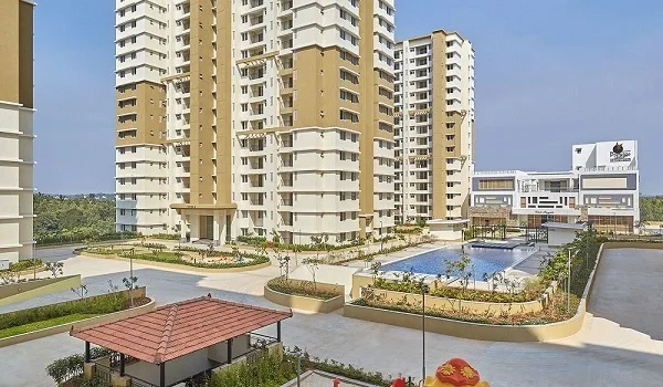
Use the ring-road master plan as context, not as the whole reason to buy. Buy on Devanahalli's fundamentals today, the operational airport, the NH-44 access, the quality of the specific project and its price, and then treat the STRR, PRR, suburban rail and airport metro as staged upside that can improve access and resale as they come online. A branded township on the belt such as Godrej Devanahalli by Godrej Properties sits within this maturing grid, close to the airport and the NH-44 spine today, with the ring roads as future upside. Before you commit to a plot or apartment, check the current status of the corridor stretch nearest it, because a benefit that is years away should not carry today's price.
For end users, the practical gain is a home that becomes easier to move around from as the grid matures; for investors, it is a corridor whose catchment and liquidity should widen as each milestone lands. Either way, verify timelines against official sources, weigh the location on what exists now, and let the ring roads strengthen an already sound decision rather than substitute for one. Shortlist a project on the belt, confirm the connectivity that matters to you, and book a site visit before you decide.
Bottom line: buy on today's fundamentals, verify each corridor's status, and count the ring-road grid as upside that makes a sound Devanahalli decision stronger.
Frequently Asked Questions
1. What is the STRR and how does it affect Devanahalli?
The Satellite Town Ring Road is a long outer ring linking towns around Bengaluru, including the Devanahalli belt. It improves regional access and freight movement, which supports land value along the corridor.
2. What is the Peripheral Ring Road?
The Peripheral Ring Road is a proposed high-speed ring linking Tumakuru Road to Hosur Road on Bengaluru's outer edge, meant to ease city traffic and connect the northern and eastern corridors.
3. Will the ring roads increase Devanahalli property prices?
Better ring-road access historically lifts land and apartment demand along a corridor. Devanahalli can benefit, but gains depend on the projects actually being built to schedule, so treat timelines cautiously.
4. Are the STRR and PRR fully built yet?
No. Both are being developed in phases, with sections at different stages of land acquisition and construction. Always verify the current status of the stretch nearest a project before you buy on it.
5. How do ring roads help a buyer in Devanahalli?
They shorten travel to other suburbs and highways without going through the city core, widen the job and social-infrastructure catchment, and can improve resale as connectivity matures.
6. Should I buy in Devanahalli only for the ring roads?
No. Treat ring-road access as upside, not the whole case. Buy on today's fundamentals, such as the airport, existing roads, project quality and price, then count the ring roads as a bonus.
Conclusion
The STRR and PRR are the road half of the connectivity story reshaping Devanahalli, working alongside the airport, the highways, suburban rail and the metro to turn the northern belt into a genuine junction of road, rail and air. As the ring-road grid matures, it widens the area a home connects to, broadens the jobs and amenities within reach, and can lift demand and resale in stages. The discipline is to buy on what exists today, verify the status of each corridor against official sources, and treat the proposed stretches as upside rather than a promise. Read the location on its current fundamentals, and let the ring roads make a sound decision stronger.
Godrej Devanahalli Blog